Friday, March 31, 2017

Grand Canyon of Tuolumne, Yosemite, Sierra Nevada Backpacking 2009

The Robinson Twins just posted a video about Rick's third backpacking trip to the Grand Canyon of the Tuolumne River in Yosemite National Park. He went hoping to show others the string of waterfalls down the Tuolumne River in this canyon, but a forest fire prevented him from going far enough downstream to see all of them. So, of course, that means we have to go again. This video is only about 20 minutes long, so enjoy! Here's the link: https://youtu.be/QHhMT0NjV40

Here is a still photo Rick took of the Tuolumne Falls on the trip shown in the video.


Remember, it's no just a picture (video), it's a story!

Sunday, March 26, 2017

Robinson Twins - American River Parkway

Our first recreational video, The American River Parkway, was video-recorded in 1999 and released in 2000. This part of Sacramento is our home turf, so to speak, so we wanted to make it first. We went to college by walking along the American River, we've biked the parkway's length several times, go jogging along it, and have paddled most of it. For the video, we also flew over it in a small airplane. We hope you enjoy the adventure that's within easy reach of hundreds of thousands of people in Sacramento County, California. Here's the link to our video: https://youtu.be/gmbOhAckfc8

The picture is from our airplane flight and shows Discovery Park and the confluence where the cleaner American River joins the muddier Sacramento River. The closer bridge is Jibboom Street while the larger bridge is Interstate-5. Old Sacramento State Historic Park is nearby to the right of this photo (not shown).


Remember, it's not just a picture (video), it's a story!

Tuesday, March 21, 2017

Teton Crest Adventure (The "Real" Teton Crest)

We've put our video of the backpacking trip we took to cover the Teton Range in 1999 online. There is a Teton Crest Trail mostly in Grand Teton National Park, but the National Forest on the western side of range also had a Teton Crest Trail, which actually covers a longer stretch of these mountains. We backpacked on the Forest Service's trail but discovered after completing our trip that the Forest Service trail is no longer maintained. We had to do some route finding at the north end, so we had a little bit of a challenge starting out. We backpacked from the Hominy Peak trailhead in the Jed Smith Wilderness, Targhee National Forest to the Rendezvous Mountain tram at Teton Village. The trip was in September so we hardly saw anyone else and the weather was clear until the last day. The high point of the trip was at Table Mountain, where we could look across Cascade Canyon at the Grand Teton peak, only about 2 miles away.

Here's the link to the YouTube video: https://youtu.be/k3Sj6CJY4_Y

Remember, it's not just a picture (video), it's a story!

Sunday, March 19, 2017

Half Dome reflected in the Merced River in September


This picture of Half Dome was taken in September of 2012 after the summer heat subsides and the weather cools leading into autumn. It was actually taken after the autumnal equinox of September 22nd. This is a very popular spot for taking a picture of Half Dome such that it is reflected in the Merced River. You can park next to Cook Meadow, then walk over to the Sentinel Bridge that crosses the river in order to look eastward at Half Dome. We tend to avoid Yosemite during the summer because of the crowds, but in more recent years we've decided to go ahead and visit during the summer anyway.

Drive over the bridge in the evening and you might find it packed with photographers hoping to get the reddish glow of the setting sun reflected from the face of Half Dome. The best time to get pictures of Half Dome is in the afternoon and evening since the face is in shadow throughout the morning. The face has a slight northeast to southwest angle, so it isn't lighted by the sun until afternoon.

Remember, it's not just a picture, it's a story!

The Maze in Anza Borrego Desert State Park, east of San Diego, California


This feature is called "The Maze" and is within the Anza-Borrego Desert State Park in California, east of San Diego. In some places, you have to turn sideways to get through. The last time I went through it, we encountered a couple of men racing up through the maze with their GPS units recording their hike. We had to pull over to one of the small pockets on the side to let them pass. We had parked near the upper end, where these hikers parked at the lower end and hiked up. We didn't make it all the way to the bottom since we had other places we wanted to see that day, so we turned around soon after encountering the other hikers.

This picture was taken at ISO 400, 18mm focal length, f3.5 and 1/60 second, vertically to emphasize how steep this feature really is.

Remember, it's not just a picture, it's a story!

Tuesday, March 7, 2017

Lexington Arch in the south end of Great Basin National Park in Nevada


Lexington Arch is a limestone arch in the southern part of Great Basin National Park in Nevada.  To get here you have to drive on dirt roads and then hike about a mile and a half on a rugged trail.  The fact that this arch is composed of limestone is very noteworthy, since most of the arches in the West occur in sandstone.  The fact that this rock span occurs in limestone may mean that it was once part of a cave that has eroded away.  Or it may be that the stream that carved Lexington Canyon carved this span when the canyon was much shallower, in which case this arch would actually be a natural bridge.

Remember it's not just a picture, it's a story!

Tuesday, February 21, 2017

Rick in Yosemite above Tunnel View, selfie with shadow


Rick is in Yosemite working on getting a picture of the firefall on February 12, 2017. Along the way, we stopped at Badger Pass for some cross-country skiing and snowshoeing, then stopped at the parking area uphill of the Wawona Tunnel. From this area, Rick decided to try getting a selfie after looking at Yosemite Valley and Cascade Creek. After he took it, he discovered that he got his own shadow when taking this selfie. Make's for an interesting effect.

Remember, it's not just a picture, it's a story!

Wednesday, February 15, 2017

Horsetail Falls in Yosemite showing the firefall effect.


In Yosemite, a rare event called the "firefall effect" happens for about two weeks, one week on either side of February 18th, along the eastern ridge of El Capitan. The sun sets at such an angle that the cliff of this eastern ridge is lit up by the setting sun, which can glow red when the conditions are right. A seasonal waterfall named Horsetail Falls can catch this red light and take on a glowing appearance to the point where it can appear to be on fire or like a lava flow.

This image was taken on February 12, 2017, around 5:30 PM. The light from the setting sun turned a shade of pink but never turned fully red. Actually getting a deep red sunset works out better when there is more dust in the air. The whole state of California has had many storms this season and the air has been pretty well cleared of dust for now.


This picture is one that I took on February 16, 2007, ten years ago. This was my first attempt to capture this event after I had learned about it.

Remember, it's not just a picture, it's a story!

Tuesday, January 31, 2017

Bob at Moss Cave in Craters of the Moon next to the Bridge of Tears, almost 20 years apart

Bob having dinner at camp by Moss Cave, Craters of the Moon, late 1990's

Bob hiking next to Moss Cave in August 2016, Craters of the Moon

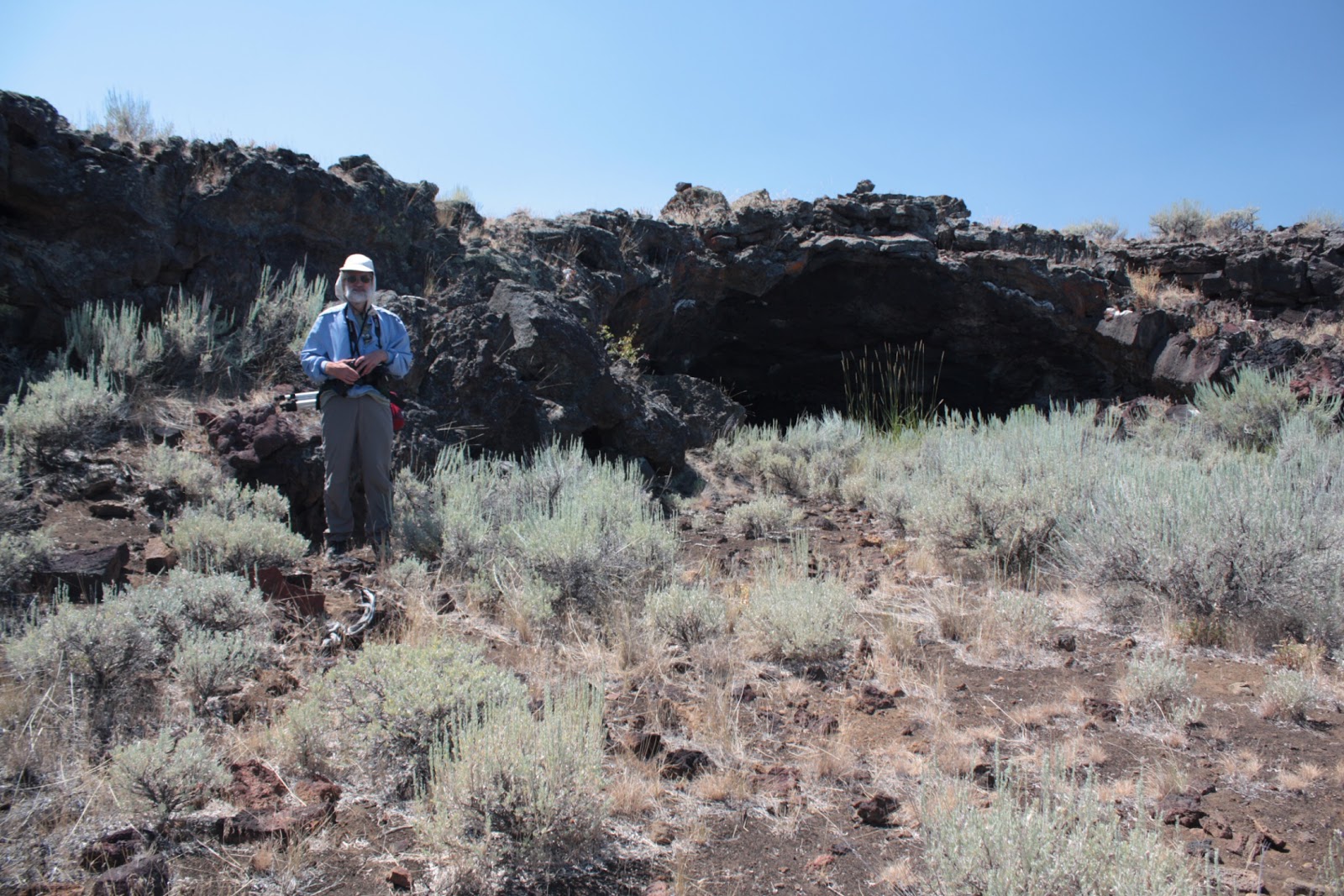
In the late '90's, we backpacked into the Craters of the Moon Wilderness to find the Bridge of Tears, Amphitheater Cave, and Moss Cave. Craters of the Moon is known to be a very windy place, so we set up our camp on top of a collapsed lava tube, which ends up being like a trough, for better wind protection. Rick took the above picture of Bob having dinner near our tent with Moss Cave's entrance behind the tent in that image.

In 2016, we went back to the Craters of the Moon Wilderness to pay another visit to the area and to see the cave we discovered. Because we were the first to describe the cave's location in writing, we got to name it. Since we, the Robinson Twins, discovered it and it had two openings, we called it Twin Cave. During this return trip, we went to the Bridge of Tears and Moss Cave where I had Bob pose in about the same spot where we had camped almost 20 years earlier, as you can see in the bottom photo.

Remember, it's not just a picture, it's a story!

Saturday, January 28, 2017

Half Dome in the winter with clouds all around


To get this image, we skied out along the Glacier Point Road in Yosemite National Park. The road is open during the summer for people to drive to Glacier Point and look down at the view of Yosemite Valley and across at Half Dome. During the winter, the road isn't plowed, so getting to Glacier Point means skiing or snowshoeing, usually. You would park your car at the Badger Pass Ski Area, then ski or snowshoe 10.5 miles (about 17 km) to reach Glacier Point. This view is from along the road but before reaching the point itself. A couple of turnouts before the point offer spectacular views, as well.

This image was captured on film years ago and scanned more recently for inclusion on our blog.

Remember, it's not just a picture, it's a story!

Monday, January 23, 2017

Bridalveil Falls along Highway 50, between Sacramento and Lake Tahoe


Bridal Veil Falls along Highway 50 east of Pollock Pines in January 2017.  This was after a series of storms had come through and helped bust California's drought.  This waterfall is readily accessible having its own turnout right off the highway.  This waterfall is formed where Esmeralda Creek falls 80 feet and then passes under the highway.

Remember, it's not just a picture, it's a story!

Saturday, January 21, 2017

Entering Yellowstone National Park...Yay!

So we're happy to enter Yellowstone's western entrance and give that a thumbs-up.


But then when it's time to leave, we give that a thumbs-down and wish we didn't have to go.


We took these twin-selfies, using a Samsung Galaxy S III on a selfie stick, in August 2016 at West Yellowstone at the entrance to Yellowstone National Park.

Sunday, December 18, 2016

Pitcher plants in Oregon, green but deadly


These pitcher plants that we found in the Kalmiopsis Wilderness in Oregon, are insect-eating plants. The insect crawls into the opening at the top to follow the scent to the inside of the tube, but downward-projecting hairs and a slippery surface cause the insect to be trapped inside. When it falls into the liquid inside the tube, it dies and is digested. The plant benefits from the extra nutrients. The pitcher plant tends to grow on nutrient-poor soil, so the extra nutrition gives it the chance to in places where poor soil might prevent it.

We backpacked into the Kalmiopsis Wilderness to look for and photograph the rare Kalmiopsis flower, but found many other interesting plants, too.

Remember, it's not just a picture, it's a story!