Showing posts with label cave. Show all posts

Sunday, July 19, 2026

Jiu Dong Tian Caves, Arch in China


On our visit to China, we toured the Jiu Dong Tian Cave system by boat. We had to take a tour bus down the river, hike down the river to a bridge, cross over, then take another tour bus down the other side of the river, then hike down into a cave before boarding boats to continue on through the caves. We went under this huge arch as part of the hike down to the dock. For size comparison, you can see a picnic table with a red umbrella and people standing under it. After emerging from the cave, there was another dock where others could go on the tour by going upstream. Normally, we would've continued farther down river and taken another tour bus back, but recent storms caused damage downstream, so we ended up going back through the cave a second time by traveling upstream to the original dock.

The Chinese word for cave is "dong." The Chinese word for window is "tian." So where Americans might call this feature a natural arch, the Chinese often call these features a "cave window."


Canon EOS 6D Mark II, 46 mm, f22, 1/45 sec, ISO 1600


Remember, it's not just a picture, it's a story!

Thursday, July 9, 2026

Qingxudong Arch, near Dafang, China, 7th largest in the world


Qingxudong Arch has been measured by laser rangefinder to have a span of 251 feet (76.5 meters) and a height of 246 feet (75 meters). That happened in 2015 by Natural Arch and Bridge Society member Gunter Welz. We used our own laser ruler when we visited on May 19, 2026, and basically confirmed those numbers. This arch had plenty of visitors and cars, vans, and even a small motorhome parked underneath. It's located near the village of Yang Chang Ba in Guizhou Province, China. In terms of span, the Qing Xu Dong Arch is considered the 7th-largest arch in the world. There's a small stream flowing under it. Beyond the arch, the stream curves into a cave and ends up going underground. It's very spectacular. The Chinese word dong translates to "cave" Instead of calling these features "natural arch", the Chinese tend to use either "heaven's gate" or "cave with window."

Coordinates where the photograph was taken: 27.10285° N., 105.6703° E.

Samsung a52, 1/216 sec, 1.7mm (13mm in 35mm equivalent),  f2.2, ISO Auto

Remember, it's not just a picture, it's a story.

Monday, November 6, 2023

Oregon Cave flowstone feature, frozen waterfall or cascading mineral formation


A tall column of cascading flowstone in Oregon Cave National Monument. The interior of a solution cave forms as water containing carbonic acid drips through the ground and dissolves the limestone or marble. Then continued dripping water leaves behind the calcium carbonate mineral as the water evaporates. The mineral builds up over several centuries to create features like this flowstone that looks like a frozen waterfall.

The original wall of a cave is referred to as speleogen, while the mineral deposits added later are called speleothems. So, this flowstone is an example of speleothem formation.

Remember, it's not just a picture, it's a story!

Monday, January 27, 2020

Robinson Twins Exploring Millerton Cave


In these two combined images, Rick and Bob are exploring Millerton Cave, located in eastern Fresno County, California. It's perhaps one of the best examples of a talus cave (also called corrasional cave) in the world. Rick is in the left image hoping to locate a small waterfall inside the cave. Bob is in the right image recording video of the inside of the cave while Rick provides the lighting. We've been to this cave several times but have yet to explore all of it. It's estimated to be 1/2 mile (.8 km) in length. It's located on public land controlled by the Bureau of Land Management called the San Joaquin River Gorge. It's also upstream of the Millerton Lake State Park. For those exploring it, there are some bolts already drilled into the granite at some of the natural entrances.

Remember, it's not just a picture, it's a story!

Thursday, April 20, 2017

Lehman Cave in Great Basin National Park, Nevada


During the 2017 Spring Break, we went to visit the Great Basin National Park in Nevada. It's not nearly as well known as many other parks, but it's the biggest National Park unit in Nevada. It used to be called Lehman Cave National Monument, but it was enlarged and made a National Park in 1986.

The Park Service offers cave tours to help show the features of the cave while also protecting them. The natural entrance is no longer used for entering and exiting the cave, instead, you enter and exit through separate tunnels that are sealed with doors at both ends. We tended to be the last ones to move along the tour since we took lots of photos.

Remember, it's not just a picture, it's a story!

Tuesday, January 31, 2017

Bob at Moss Cave in Craters of the Moon next to the Bridge of Tears, almost 20 years apart

Bob having dinner at camp by Moss Cave, Craters of the Moon, late 1990's

Bob hiking next to Moss Cave in August 2016, Craters of the Moon

In the late '90's, we backpacked into the Craters of the Moon Wilderness to find the Bridge of Tears, Amphitheater Cave, and Moss Cave. Craters of the Moon is known to be a very windy place, so we set up our camp on top of a collapsed lava tube, which ends up being like a trough, for better wind protection. Rick took the above picture of Bob having dinner near our tent with Moss Cave's entrance behind the tent in that image.

In 2016, we went back to the Craters of the Moon Wilderness to pay another visit to the area and to see the cave we discovered. Because we were the first to describe the cave's location in writing, we got to name it. Since we, the Robinson Twins, discovered it and it had two openings, we called it Twin Cave. During this return trip, we went to the Bridge of Tears and Moss Cave where I had Bob pose in about the same spot where we had camped almost 20 years earlier, as you can see in the bottom photo.

Remember, it's not just a picture, it's a story!

Friday, July 18, 2014

Sequoia-Kings Canyon's Crystal Cave showing cave drapery


This image was taken while on a tour of Crystal Cave in Sequoia National Park. Caves of this type form underground by water that has become weakly acidic by absorbing carbon dioxide, then dissolving away limestone or marble to create a cavity in the earth. The original rocks of the cave wall are collectively called speleogen. This type of cave is called a solution cave, due to the way it forms. After forming, the water continues dissolving minerals underground and dripping down through the cave. When the drops dry up, the calcium carbonate mineral is left behind, forming the cave features most people associate with caves. These formations are normally white, but may be tinged with orange or reddish streaks if the minerals have iron mixed in. These features that form after the cave walls, speleogen, are called speleothems. These particular kinds of speleothems are called cave draperies.

Photographically, the white calcium carbonate makes for a challenge since it can end up washed out by the flash. Having the light bright, but diffused, helps create an even lighting across the surface of the features instead of having a bright spot where the light from the flash ends up being too concentrated. A simple technique for achieving this effect is to move farther away from the features and use the telephoto zoom lens in combination with the flash, which is how this image was made. Not only will the light be softer, but cave drapery and other bright cave features to the side will reflect the light soften the shadows.

Remember, it's not just a picture, it's a story!

Monday, September 9, 2013

Wind Caves at Anza-Borrego Desert State Park, California


Looking almost like housing from The Jetsons, the Wind Caves in Anza-Borrego Desert State Park, California, are found above the Fish Creek Wash where wind-blown sands hit exposed sandstone and create alcoves and arches. To get this image, we drove into the wash from a primitive campsite we stayed at the night before, then hiked up the slope to get a closer like at this feature. This image was created by merging three overlapping images together. It is best printed at a 2 to 1 ratio, such as 8x16 or 10x20. This drive doesn't require a 4-wheel drive or high-ground clearance vehicle to get to it, but going any farther up into the wash does.

Remeber, it's not just a photo, it's a story!

Wednesday, August 28, 2013

Moaning Cavern flowstone feature, The Igloo.


Moaning Cavern is a solution cave found in California's Sierra Nevada foothills. It has a metal spiral stairway leading into the largest cave room in the state. This room is large enough to fit the Statue of Liberty inside! Flowstone refers to the features that result from water flowing in laden with minerals, which then evaporates and leaves the minerals behind to accumulate over thousands of years. The Igloo shown in the photo, had water drip onto it, then run down the sides, causing the feature called cave drapery below the top of the igloo-like part of the feature. The name of the cave came from the sound that air flowing out of its natural entrance used to make. Unfortunately the lights are on long enough that algae is starting to grow on the flowstone.

Cave features can be difficult to photograph since the photographer usually has to provide all the lighting and then position it well. This feature was lit for the tourists to see, so that made it easier to photograph from a distance. You can also see some of the features above it were also lighted.We're hoping to make a video and photo book highlighting all the cave types in California. Interesting that most people don't associate California with caves, but the state could have more than any other state, plus the five main types of caves are represented here, as well.

Remember, it's not just a picture, it's a story!
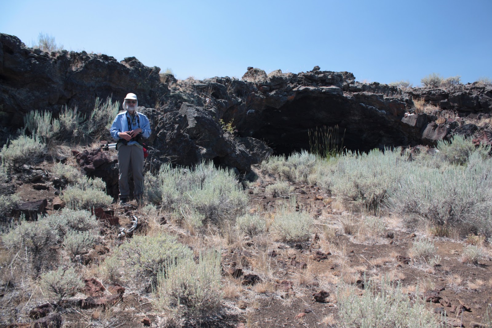
Tuesday, June 25, 2013

Subway Cave: a lavatube cave near Lassen Volcanic National Park


Subway Cave is a lava tube cave near Lassen Volcanic National Park, in the Lassen National Forest. Lava tubes form when lava flowing out of a volcanic eruption cools and forms an upper crust, but lava underneath is still warm and fluid and eventually drains out, forming a tube. When parts of the roof collapse, entrances are created. Subway Cave has two roof collapses about .3 miles apart, which allows visitors to take a short hike from one to the other. The visitor can then return to the start through the cave or take a surface trail back.

Northeastern California has at least 300 such caves, but few are as high or as easily accessible as this one, being right off a main road. The cave entrances have cement stairs for easy access. The actual lava tube continues further along than where the stairways are located, but these parts of the cave may be considered less stable and therefore more hazardous. We've hiked into the extended parts of the cave to explore it more and found that the tunnel split. Very fascinating, these features, especially when you try to imagine what the flow of hot lava would look like when the tube was forming.

Anyone wishing a print of this photo will need to keep its dimensions in mind when ordering.  The dimensions that our online photo processing offers that applies to this image is 2x1 (or 8.5x17 legal size paper).

Remember, it's not just a picture, it's a story!