Tuesday, January 31, 2017

Bob at Moss Cave in Craters of the Moon next to the Bridge of Tears, almost 20 years apart

Bob having dinner at camp by Moss Cave, Craters of the Moon, late 1990's

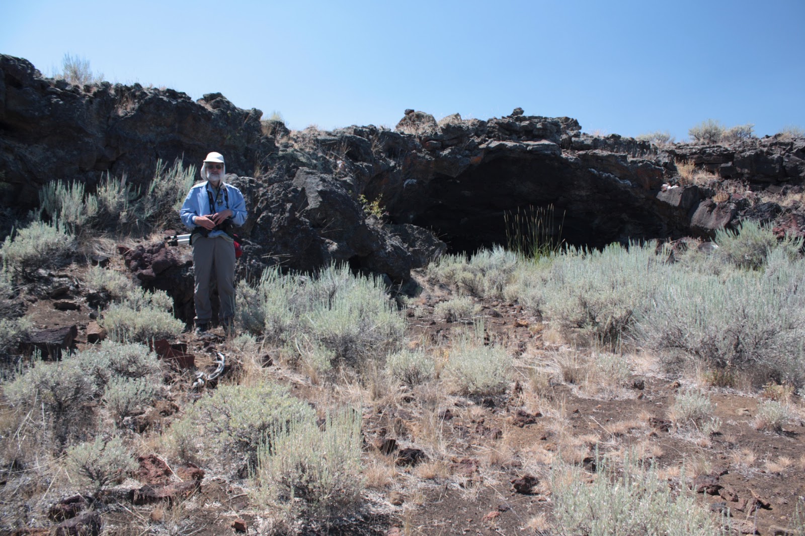
Bob hiking next to Moss Cave in August 2016, Craters of the Moon

In the late '90's, we backpacked into the Craters of the Moon Wilderness to find the Bridge of Tears, Amphitheater Cave, and Moss Cave. Craters of the Moon is known to be a very windy place, so we set up our camp on top of a collapsed lava tube, which ends up being like a trough, for better wind protection. Rick took the above picture of Bob having dinner near our tent with Moss Cave's entrance behind the tent in that image.

In 2016, we went back to the Craters of the Moon Wilderness to pay another visit to the area and to see the cave we discovered. Because we were the first to describe the cave's location in writing, we got to name it. Since we, the Robinson Twins, discovered it and it had two openings, we called it Twin Cave. During this return trip, we went to the Bridge of Tears and Moss Cave where I had Bob pose in about the same spot where we had camped almost 20 years earlier, as you can see in the bottom photo.

Remember, it's not just a picture, it's a story!

Saturday, January 28, 2017

Half Dome in the winter with clouds all around


To get this image, we skied out along the Glacier Point Road in Yosemite National Park. The road is open during the summer for people to drive to Glacier Point and look down at the view of Yosemite Valley and across at Half Dome. During the winter, the road isn't plowed, so getting to Glacier Point means skiing or snowshoeing, usually. You would park your car at the Badger Pass Ski Area, then ski or snowshoe 10.5 miles (about 17 km) to reach Glacier Point. This view is from along the road but before reaching the point itself. A couple of turnouts before the point offer spectacular views, as well.

This image was captured on film years ago and scanned more recently for inclusion on our blog.

Remember, it's not just a picture, it's a story!

Monday, January 23, 2017

Bridalveil Falls along Highway 50, between Sacramento and Lake Tahoe


Bridal Veil Falls along Highway 50 east of Pollock Pines in January 2017.  This was after a series of storms had come through and helped bust California's drought.  This waterfall is readily accessible having its own turnout right off the highway.  This waterfall is formed where Esmeralda Creek falls 80 feet and then passes under the highway.

Remember, it's not just a picture, it's a story!

Saturday, January 21, 2017

Entering Yellowstone National Park...Yay!

So we're happy to enter Yellowstone's western entrance and give that a thumbs-up.


But then when it's time to leave, we give that a thumbs-down and wish we didn't have to go.


We took these twin-selfies, using a Samsung Galaxy S III on a selfie stick, in August 2016 at West Yellowstone at the entrance to Yellowstone National Park.