We are twin brothers devoted to Earth adventures and environmental protection. We've been buddies since we were in utero. We produce videos, in high and ultra-high definition, photographs, articles, and books covering topics on understanding and enjoying National Parks, natural and human history, including native cultures. Our YouTube channel has videos on the above topics. Search Robinson Twins, Richard and Robert. At the bottom of the page, click on Older Posts to see more.
Tuesday, December 12, 2023
Columbine flowering in the Snake River Canyon. Idaho
Monday, July 24, 2023
Shoshone Falls double rainbow, July 1, 2023
While waiting for the night to fall to look for moonbows in Shoshone Falls, we spent the afternoon getting photos of the falls during the day, including seeing this double rainbow in the mist of the falls.
These falls are east of Twin Falls, Idaho and at this viewing, there was a good flow of water, thanks to releases from upstream dams on the Snake River. This view is from the main viewing platform for the falls in Shoshone Falls Park.
Remember, it's not just a picture, it's a story.
Monday, July 17, 2023
Moonbow in Upper Mesa Falls, Mesa Falls Scenic Byway, Caribou-Targhee National Forest, Idaho
After our successful photo trip to Shoshone Falls to see a moonbow in its mist (see the previous post), we headed to the Mesa Falls Scenic Byway to see if we could photograph a moonbow in Upper Mesa Falls along the Mesa Falls Scenic Byway in the Caribou-Targhee National Forest in eastern Idaho. We had heard from a forest supervisor about a year ago that she already knew that someone had photographed a moonbow in Upper Mesa Falls, so we knew it could happen.
We hadn't modeled the terrain and moon's path ahead of time, so we didn't know where the best vantage point was or when it might happen. We headed to the main observation platform the night of the full moon, Monday, July 3rd. The moon was rising behind a cloud bank along the eastern horizon. As soon as the moon cleared the clouds, its light shot up the canyon making the whole streamcourse glow up to and beyond the Upper Mesa Falls. We saw this moonbow almost as soon as the moonlight set the canyon aglow around midnight. It appeared fairly close to the waterfall itself and progressed toward the waterfall as the moon rose. It soon seemed that the moonbow would be drowned out by the waterfall itself.
We moved to another observation platform to our left and caught sight of another moonbow and watched it as it progressed to the right, toward the waterfall, just like the previous one had done. We left around 2 AM with that moonbow still visible, but getting very close to the waterfall and we presumed that it was about to disappear.
The photo above is of that initial moonbow sighting and is a vertical in order to show the stars in the sky to prove that it was taken at night.
Remember, it's not just a picture, it's a story.
A Moonbow in Shoshone Falls, Twin Falls, Idaho
We have for the last dozen years or so been making a nearly annual pilgrimage to Yosemite to see the famous moonbows in Lower and Upper Yosemite Falls. We have long thought that moonbows might occur in other waterfalls, but that few others have thought to look for them there.
With that in mind, we headed to Twin Falls, Idaho to visit the "Niagara of the West," Shoshone Falls, east of the city along the Snake River. We got special permission to spend the night there on the night of Saturday, July 1st, two days before the night of the full moon.
Much to our delight, we did see a moonbow in the mist of the gushing waterfalls that is Shoshone Falls. It first appeared in the far left end of the mist cloud just before midnight and progressed to the right as the moon climbed higher in the sky. When we left at 2 AM, the moonbow seemingly had pressed itself against the cliff to the left of the waterfall in this view and had shortened to just a stub.
But that means that a waterfall that wasn't known for producing a moonbow, not only produced one for us, but that it lasted for some two hours two nights before the full moon night.
Thanks to Wendy Davis of the City of Twin Falls Parks and Recreation Department for allowing us the opportunity to photograph and videograph the moonbow in Shoshone Falls. Check out our YouTube timelapse video of this event in our Nature Observations playlist.
Remember, it's not just a picture, it's a story.
Friday, December 8, 2017
Window Arch in City of Rocks National Reserve
Window Arch is one of many arches and other granite features in the City of Rocks National Reserve, in southeastern Idaho. This feature can be reached by hiking an easy 0.1 mile trail from the parking spot for campsite number 37. It is situated along a ridge that allows for getting good photos of it from either side. I chose this side because of the interesting cloud formations in the sky that you can see under the arch.
To give you a better idea about the size of the arch, look at the picture below with Rick standing in it.
Friday, August 25, 2017
It was totality worth it! The total solar eclipse over the Tetons August 21, 2017
This is a still from the video I, Bob shot of the total solar eclipse on August 21, 2017 with my GoPro Hero 4 Black. I've posted that video on our YouTube Channel.
I backpacked in to the Jedediah Smith Wilderness Area on the west slope of the Tetons to the top of Table Mountain to observe and record the total solar eclipse with the classic Le Trois Tetons view for the landscape. The small black dot surrounded by white in the upper middle of the frame is the moon eclipsing the sun. The three main peaks on the horizon are the Grand, Middle, and South Tetons.
This was a totality awesome experience. I could see the moon's shadow completely blacken Teton Valley and Driggs, Idaho to the west as it raced toward me and then the sun became totally eclipsed. The partial eclipse didn't seem to be that much different from a regular sunny day, but totality was an eerily freakish experience. The sun's corona lit the earth around me with a kind of light I had never seen before. Also, the horizon in all directions looked like sunset even though most horizons never get a setting sun, plus the sun was still high in the sky.
It was totality worth it!
Tuesday, January 31, 2017
Bob at Moss Cave in Craters of the Moon next to the Bridge of Tears, almost 20 years apart
![]() |
| Bob having dinner at camp by Moss Cave, Craters of the Moon, late 1990's |
![]() |
| Bob hiking next to Moss Cave in August 2016, Craters of the Moon |
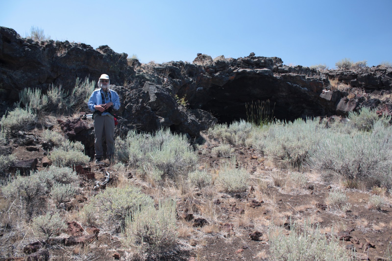
In the late '90's, we backpacked into the Craters of the Moon Wilderness to find the Bridge of Tears, Amphitheater Cave, and Moss Cave. Craters of the Moon is known to be a very windy place, so we set up our camp on top of a collapsed lava tube, which ends up being like a trough, for better wind protection. Rick took the above picture of Bob having dinner near our tent with Moss Cave's entrance behind the tent in that image.
In 2016, we went back to the Craters of the Moon Wilderness to pay another visit to the area and to see the cave we discovered. Because we were the first to describe the cave's location in writing, we got to name it. Since we, the Robinson Twins, discovered it and it had two openings, we called it Twin Cave. During this return trip, we went to the Bridge of Tears and Moss Cave where I had Bob pose in about the same spot where we had camped almost 20 years earlier, as you can see in the bottom photo.
Monday, September 12, 2016
Grand Teton cloud eruption!
On the horizon is the towering peak of Grand Teton, as viewed from the west looking east while still in Idaho. This caught Rick's attention because of the way the clouds appeared to be coming out of the peak, as though it was a volcano spewing ash. It reminded him of pictures of volcanic eruptions, so he pulled over to the shoulder of the road to get pictures of the peak and the clouds. There is another string of cloud reaching toward the ground to the right in this image, as well. This also helps to show that the west slope of the Teton Range is gradual and leads up to the peaks, unlike the eastern, more famous side of the range that is known for not having foothills at all.
The camera is a Canon Rebel EOS xSi at f/8, 1/180 sec, ISO 200, focal length 55mm (about 86mm equivalent).
Tuesday, June 21, 2016
City of Rocks National Preserve in Idaho has the Window Arch, a rare granite arch
The City of Rocks is an out-of-the-way National Preserve in south-eastern Idaho where granite spires, domes, and loaves seem to pop out of the rolling plains. Historically, this area is famous for the pioneers on the California Trail heading west and having this landmark serve as a special stop along the way. Many of the pioneers signed their names on the granite rock using axle grease. This place is also famous with climbers for some of the clean granite rock that makes for excellent climbs. We climbed one of the easier climbs in the area before taking lots of pictures. Since granite rarely forms arches, we made a point of looking for this feature, Window Arch. It's right next to a parking area for camping off of the main road through the area. Window Arch appears to be on the verge of falling down. The horizontal pieces of the arch have split and are offset from each other. It looks like either or both sides could some day soon slide past the other and collapse. Granite might form arches when sheets of granite flake off in a process called exfoliation. If both sides of a dome-shaped granite rock flake off, there may be left behind the highest part of the dome or loaf left behind, thus making an arch.
This image was made by merging two images together to increase the amount of detail in the final image. Both images taken at ISO 100, f8.0, 1/180 sec. with a Canon Rebel xSi, with a focal length of 18 mm. Rick made a point of composing this image so that the sky and top of the tree would be clear of the underside of the arch.
Monday, November 2, 2015
Fireweed blooming at Teton Pass, Wyoming
Fireweed blooming at Teton Pass at the southern end of the Teton Range in Wyoming and Idaho. Fireweed gets its name from the fact that it tends to be one of the first plants to come back into a burned area after a fire. It has an interesting habit of starting to bloom at the bottom of the flower cluster and working upward. This photo shows blooming flowers at the bottom while buds are waiting to bloom on top.
Teton Pass is at an elevation of 8,432' and is near the border between Wyoming and Idaho. The nearest large town is Jackson, Wyoming near the southern end of the mountain valley called Jackson Hole.
Thursday, April 11, 2013
Sunset over Southern Idaho volcanic butte
Sunset at one of southern Idaho's volcanic buttes, probably Middle Butte, as seen from Highways 20 and 26. Southern Idaho's Snake River Plain is an area of fairly recent volcanic activity, including the Craters of the Moon National Monument, which we have visited many times. The scene in this photo is east of the monument between the town of Arco and the city of Idaho Falls.